Leadup and Preparations
The summer of 2012 brought Brothers Enroute back to the Uintas in Utah. The plan was to revisit the Chain Lakes and then continue over the ridge to the lakes just East of Mt Emmons. The theme of this trip should have more appropriately been called Fathers and Brothers, as two fathers decided to come along with us. For me, the backpacking trip was coming the week after the STP, and I was worried that my legs wouldn’t be recovered enough to endure the miles of planned hiking. Being however that I didn’t do any sort of training in the interim, I thought I would be OK. I didn’t even bike commute the two days I went to work that week.
This year my gear had reached a holding pattern in that I hadn’t really purchased anything new to be testing out. I was happy with the gear I had, and besides a small issue I was having with the skinniness (width) of the Big Agnes air core pad, I was content. I was also so busy with preparations for riding the STP, that I didn’t have much time to think about what other new stuff I might need, or could try out.
The larger contingent of the group started out from Southern Utah in trucks picking up members of the group as they advanced north. I met them at the normal “meating” spot in Duchesne, and put my pack in and rode along with them to the trailhead. This part of every trip is always high spirited, and most guys in the group need to be peeled off the ceiling of the truck, but that makes it fun. It is always interesting that we immediately develop the same annoying tendencies of our children that we chastise as parents. “Get your finger out of your Brother’s ear”! “No spitting!”
Trailhead
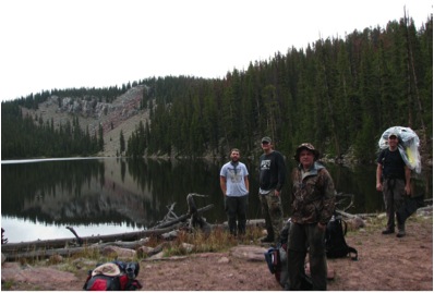
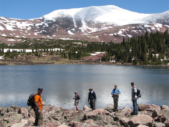
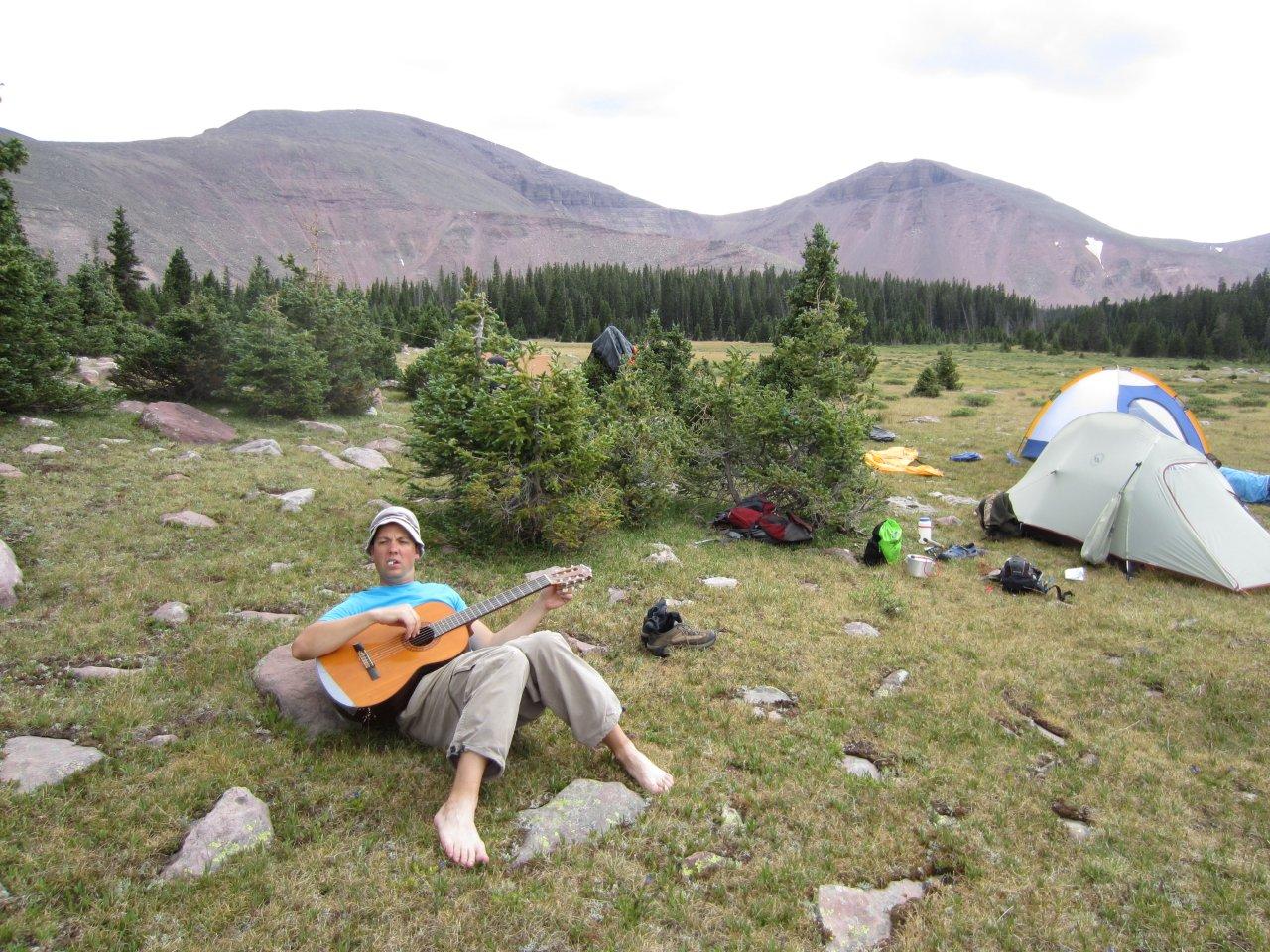
We got to the trailhead at a good time and got all the gear ready and on our backs. We had two guitars again this year and were hoping to have some good evenings of music by the campfires. With the two Fathers added to the group, we were 9 in total. Pretty big group, but we all liked each other, and got along very well. It was especially fun for the Professor and I to have our father along being that he instilled in us from a young age the desire to be in the mountains enjoying nature. It seemed only fitting to have him along to enjoy something we both had learned to do and enjoyed so much. We didn’t need to teach him anything though for repayment, we just wanted him with us.

Brothers Enroute ready for another 35 miles in the Uintas.
After getting started, we continued to be in high spirits and made fairly good time together as a group. Around mile 1, Mr. Soccer’s backpack that he had been using since he was a kid finally broke in a place that was too hard to fix “like new”. He was bummed. This was understandable too. This fell under the category of “they don’t make things like that anymore”, and it was a tried and tested backpack. It was the kind of backpack that you would find in your Dad’s garage if he had ever gotten into backpacking as a teenager or young adult. The difference here, was that Mr. Soccer had continued using it under the premise of why buy something new when this works just fine. It was a very effective backpack and very lightweight. We spent a good deal of time trying to develop a system to fix it because otherwise he would be hosed. Pop-Pop was able to produce some string and we fixed it; at least to the point that we could continue the hike. It was only barely passable, and it required him to carry the weight differently than normal, but it and he finished the trip.

The group attempting surgery on the broken backpack of Mr. Soccer.
After restarting, the group started to fall into their individual paces and resultantly spread out. Contrary to my previous fears of not having recovered well enough, I was firing on all cylinders and starting to pick up my cadence. Just before the start of the hike, the Professor had adjusted my pack so that it was sitting more evenly distributed on my shoulders and hips, and it worked so well that I wasn’t feeling it much. The concern for me at this point was to not get too far ahead. While backpacking, if I adopt a slow cadence, to stay with the group, it seems to take more effort. If I go at my own pace, I end up getting into a groove and putting the HR right in the Z2 zone with peaks into Z3 and Z4 sometimes. At this effort I found that I am good for about 12 hours as long as I keep getting nutrition. Yeah, geeky I know, but this spillover information from triathlon and cycling keeps me really tuned into my body during hikes. I also use both hiking in and hiking out as an endurance building training sessions for the race season. This is necessary at times due to the placement of the trip within the season. I have even started jogging at times with the pack when I noticed my HR dropping below Z1 (usually on the hike out).
At around three miles up this trail, the path crosses the Uinta River. An awesome footbridge has been built over the river and we used it as a rest spot to allow others to catch up. I also decided a planking photo was needed.

Mr. Soccer is amused by my lunacy and incorrect planking technique.
After restart, the group stayed together for much of the next three hours. “Catch me up on the last year” conversations were had while climbing switchbacks. After a while I started getting antsy again and picked up my pace. I knew our stopping point and decided to get there and setup camp for the group. However, a turn in the trail and a wrong intuition about the pitch of the trail ahead had me second guessing my route, so I decided to park it and wait. I was worried I had made a wrong turn. I knew I was near a patch of ponds that the group wanted to fish, so I waited on a rock while eating sunflower seeds. After what I thought was too much time, I walked back down the path to fortuitously find the group dropping packs and starting off trail to spend some time at the ponds. These ponds were really picturesque and offered a unique fishing experience similar to fishing on a floating island. The grass and dirt upon which we were standing was undercut by the water. The bank was overhung to produce a floating affect. This required that we spread our weight out, or water would seep up through the grass at our feet. Fishing was fast and furious, but only small fish just larger than fingerlings. Most of my success was with an assortment of panther martins and Jakes spinners.
Pond fishing mid-hike at overhung floating bank ponds.
Normal size of fingerling fish from ponds.
After fishing for a while at these ponds, it was decided by the group that a campsite be found sooner rather than later. The contributing factors were available remaining daylight and overall fatigue of the group. It had been a rather strenuous climb. Thus, after a short restart, a nice area on the edge of a meadow was chosen just before the last climb before summiting at lower chain lake. This campsite ended up being very memorable for the thumping stump. An old rotted out trunk on the edge of the meadow was used for percussion during that night’s campfire music session. Contributing factors of the hollow trunk, the extensive root system, and being on the edge of a grassy meadow gave this thumping stump a built in base system with impressive amplification. Reverb from the beat could even be felt by those that had already entered their bags for the night. Small serendipitous finds like that stump make Brothers Enroute happy.
Day 2: Advance the Camp
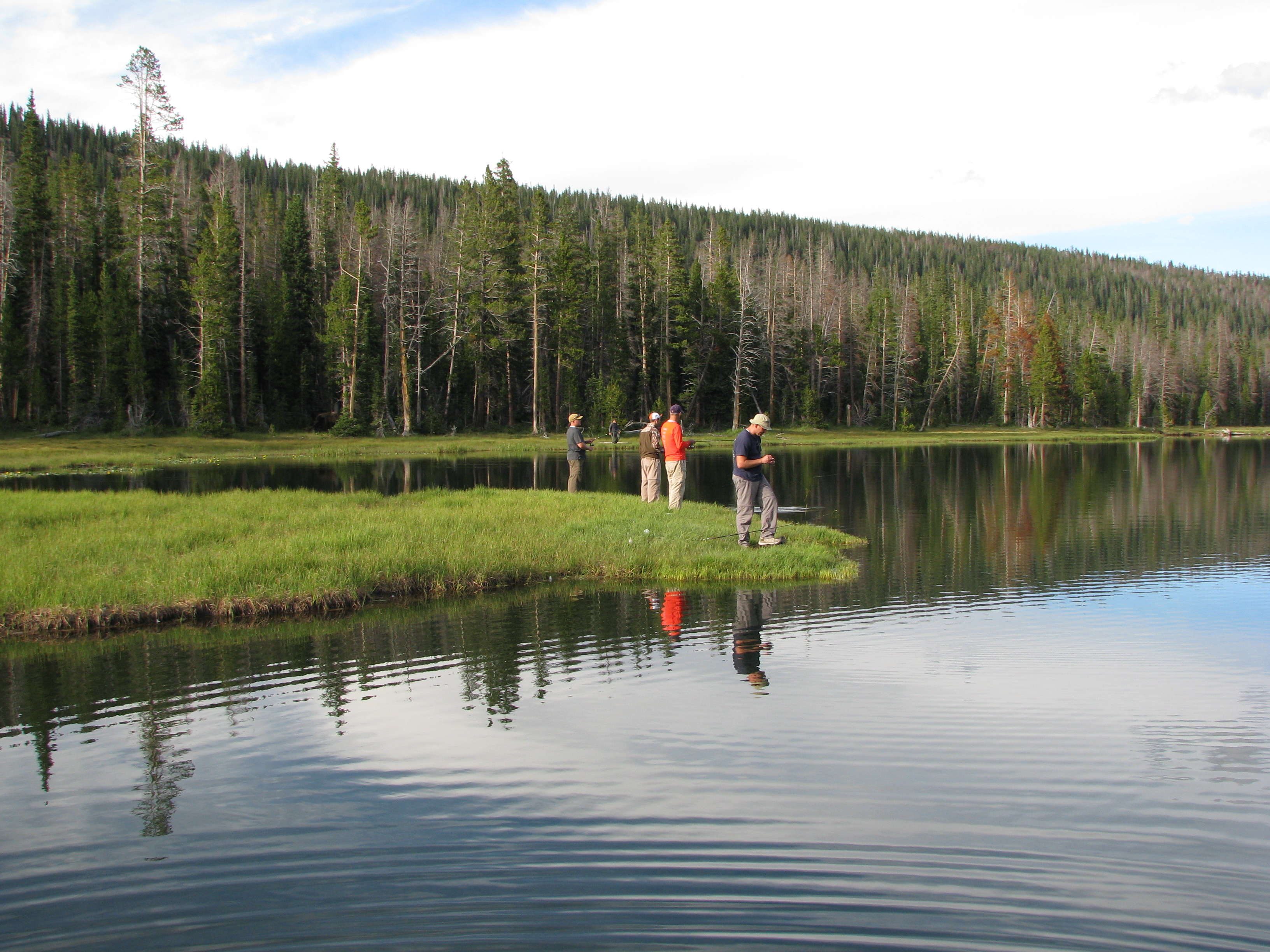
The next day was to be the long haul day. We were also excited to get in as much fishing as possible. After breakfasting, breaking camp, and donning the packs we quickly fell into a good pace together. Most of the morning was spent amongst the chain lakes with moderate success. Enough so that a fish supplemented lunch was possible. After lunch and a little more fishing, the group decided to continue on as was the plan to the next campsite. This required a saddle summit and subsequent drop to the next valley along a switchback trail amidst the familiar high Uinta rock fields.
Four years earlier the beginnings of Brothers Enroute had made this same hike as is now known as the maiden voyage. During that trip a group of horse riding drunks had passed them late one night on the trail. They were going extremely fast and pushing the horses too hard. A while later the group heard gunshots. The next day during their descent into this adjacent valley amidst these switchbacks and rock fields the group understood the reasoning for the gunshots. The idiot drunkards had pushed these horses into the night and down the switchbacks at too fast a speed to one of the poor animal’s death. The gunshots were misery shots. The group was sickened when they happened upon the dead horse four years prior, and just plain mad this year.

Horse remains 4 years later. We are still mad about this.

Smart and kind horsemen.
At this point the group started thinning again due to varying paces and I continued up the trail listening to podcasts and enjoying nature. After a few more hours of hiking I stopped in a clearing and waited for the rest of the group to catch up. It was a pleasant day and before long I had drifted off to sleep. I was awoken by the sounds of hoof-steps and a low whistle. Another pack horse group was making their way up the trail, but this group was clearly under the care of an experienced and loving group of riders. No sweat could be seen on the animals and a relatively slow pace must have been maintained. The whistle was to verify whether or not I was still alive. A quick affirmation and an “all is well” were communicated and the horsemen continued on. A short half hour later the group was intact and second camp was quickly setup.
Day 2 Campsite under Mt. Emmons.
One reason you should not drink from Mt. streams is because backpackers like us after a long day of hiking will use them to “freshen up”, and by that I mean take a bath. There are of course many reasons to not drink from a mountain stream but backpacker sweat is a good enough deterrent for me no matter how diluted.

Mr. Soccer doing his best to increase the salinity of this Mt. stream.
After freshening up, the group went for a jaunt to fish a few lakes (B-29 and Carroll) where they had success four years prior. These lakes consisted of brook trout and a few cutthroats. Fishing was relatively slow and after a little exploring aside from the fishing, the group was back in camp to eat and ready for bed.
Day 3: Fish & Summit
After Breakfast the next day the group put on their daypacks and made a later than normal start to fish at Atwood, Allred and Allen. Lake Atwood only seemed fruitful right at the dam, and nice sized fish were caught at a good frequency with Jakes and KastMasters of middle weights. As is the case with most fishing holes, after a while the frequency trailed off, and the group decided to move to the other lakes. Not as much success was had at either Allred or Allen, and by lunch the group had decided to deviate from the plan to stay the camp and opted to move it down to one of the chain lakes for an easier and shorter hike out the next day. The three brothers MSRH, Photoman, and Thumper had decided that today would be the day for a peak summit, and had already started climbing up the ridge to Mt. Emmons. Mr. Soccer and I wanted to fish at Roberts Lake because of the elevation, and also because of heard reports of the fishing quality in that lake. The Professor, Pop-Pop and the fathers decided to mosey back to camp, pack up, and slowly get back to one of the chain lakes and set up for the last night.
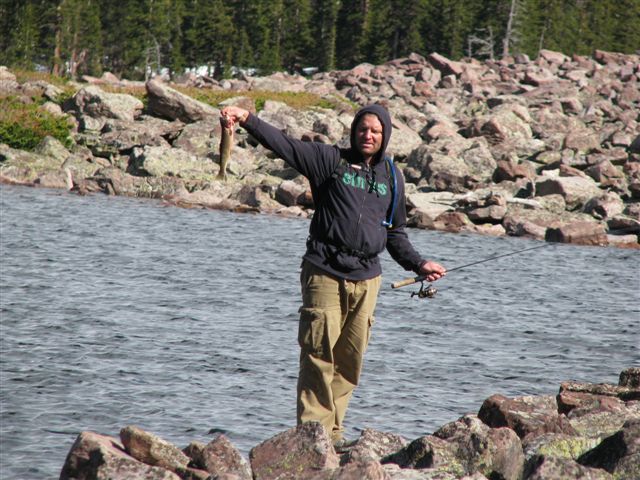
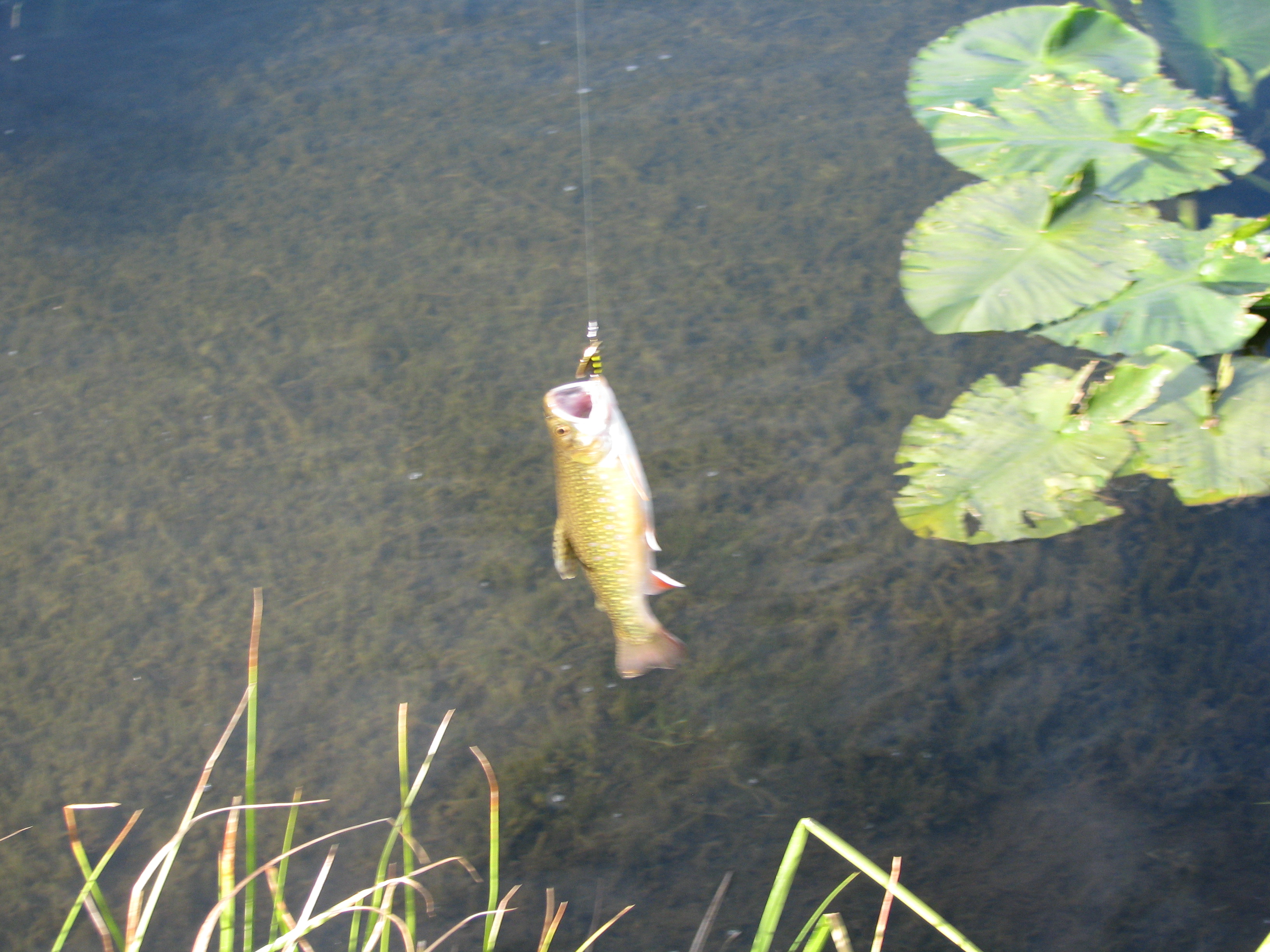
After hiking up to Roberts Lake the fishing ended up being as good as expected for about 30 minutes. I caught my largest fish of the trip and awkwardly took the below photo. It had great coloring a disproportionate head, and battle scars as is typical of a high elevation Brook Trout. Though the photo might not do it justice, it was somewhere in between 2 and 3 pounds. It fought for about 5 minutes too. A fish like that can sometimes make a trip, but the photo documentation is good and bad. Good so that people believe you, bad in that you can’t increasingly stretch the size of the fish over time.

Fish of the Trip; a Brook Trout circa 2.5 lbs at an Elevation of 11,500 ft.
The three brothers at this point were well into their summiting attempt and had found some tale-tail signs of some Mt. Goats.
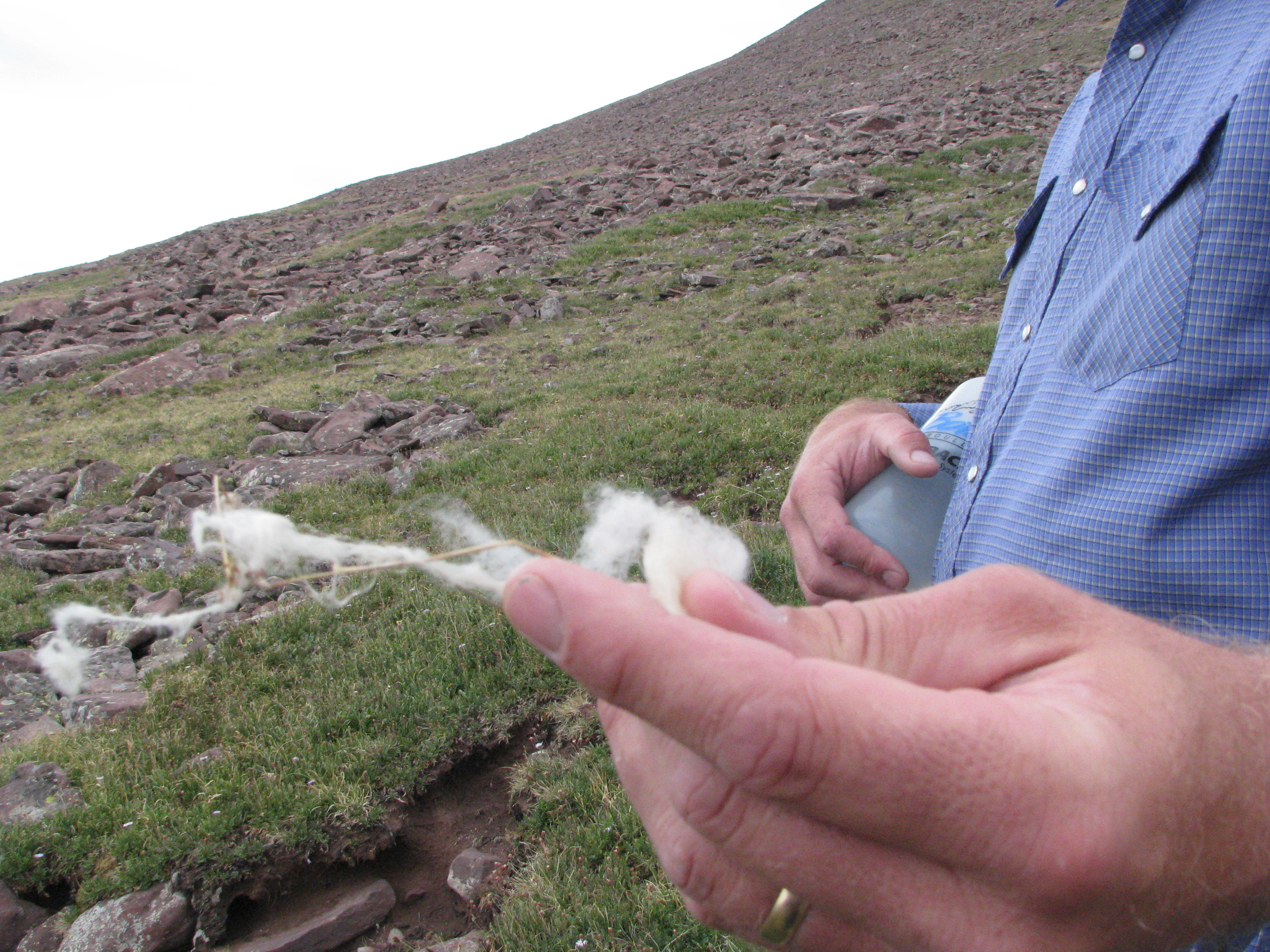
MSRH with the wool of a Mountain Goat.
Shortly thereafter they saw this:
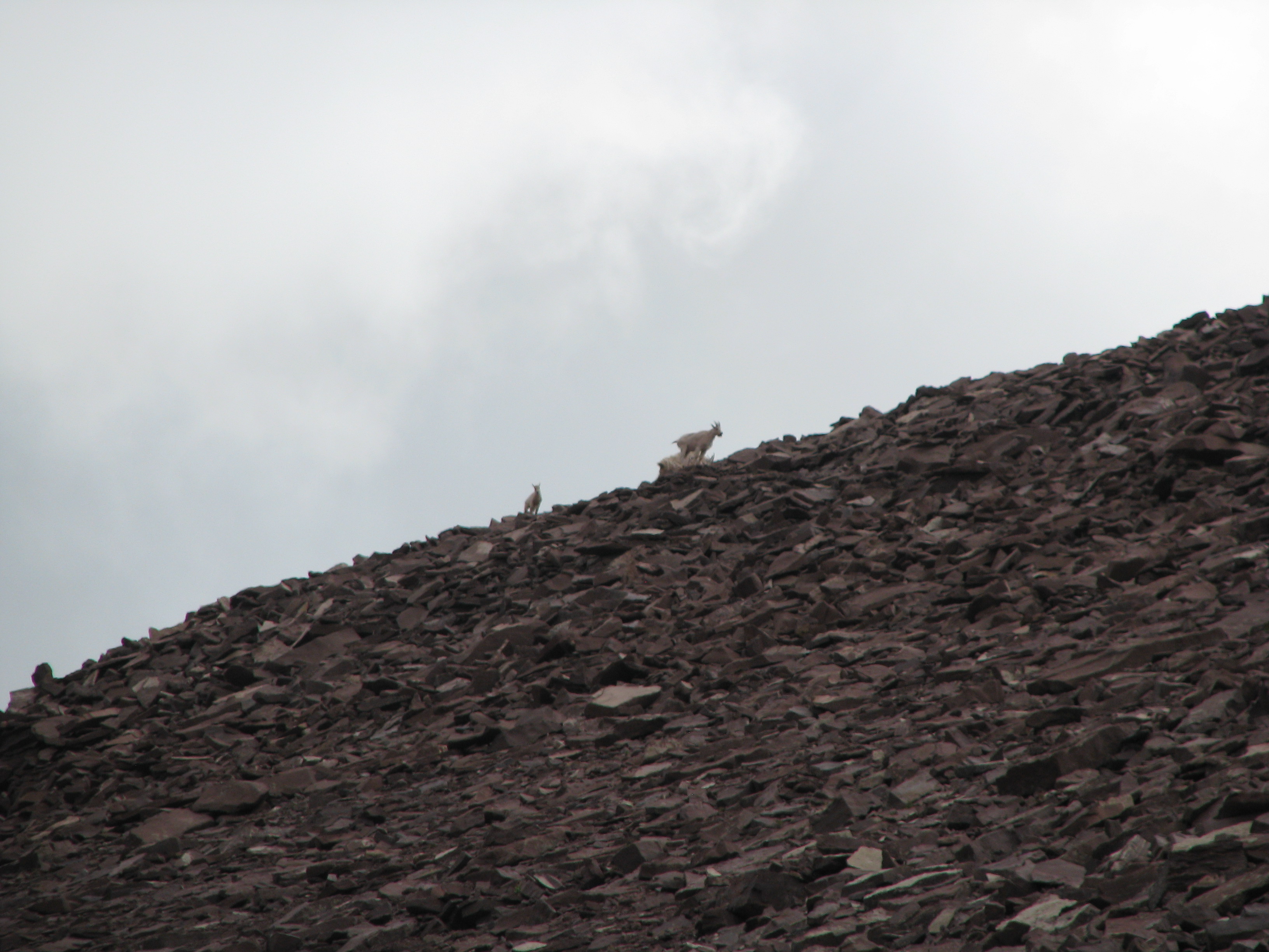
Mountain goats on Skyline during Mt. Emmons summit.
Then they heard some falling rocks and saw this just to their side. With poise Photoman was able to capture the moment perfectly.
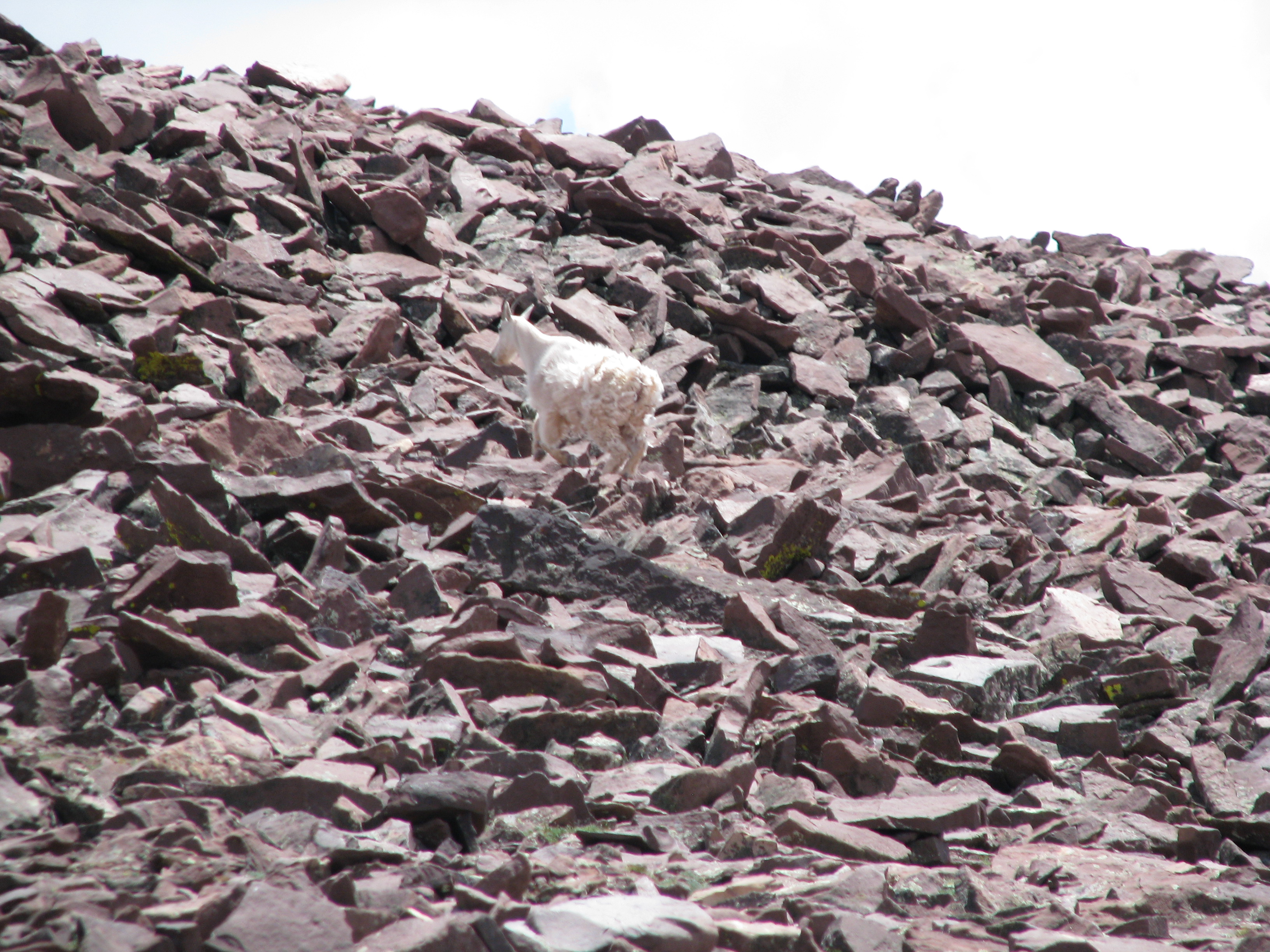
Mother Goat making her way away from the three brothers.
After playing around with the goats during the hike, the three brothers decided to make it up to the Mt. Emmons summit. It was not a difficult hike but more so annoying hopping from rock to rock and assuring the rock was sturdy. They also knew nothing of our plans to move camp, so they didn’t expect to require time to get back to the chain lakes after their summit and did so at an even pace. Mr. Soccer and I at this point had already satiated our high elevation fishing desire, and had returned back to camp. Because we didn’t have a way of communicating our change of plans to the brothers, we wrote a message with drying socks and pine cones that simply said Chain Lakes. If they remembered their socks, they would see the message, and hopefully have enough light and energy to make it down.

MSRH, Photoman, and Thumper on ridgeline peak to the North of Mt Emmons.
Where they were rewarded with this view.
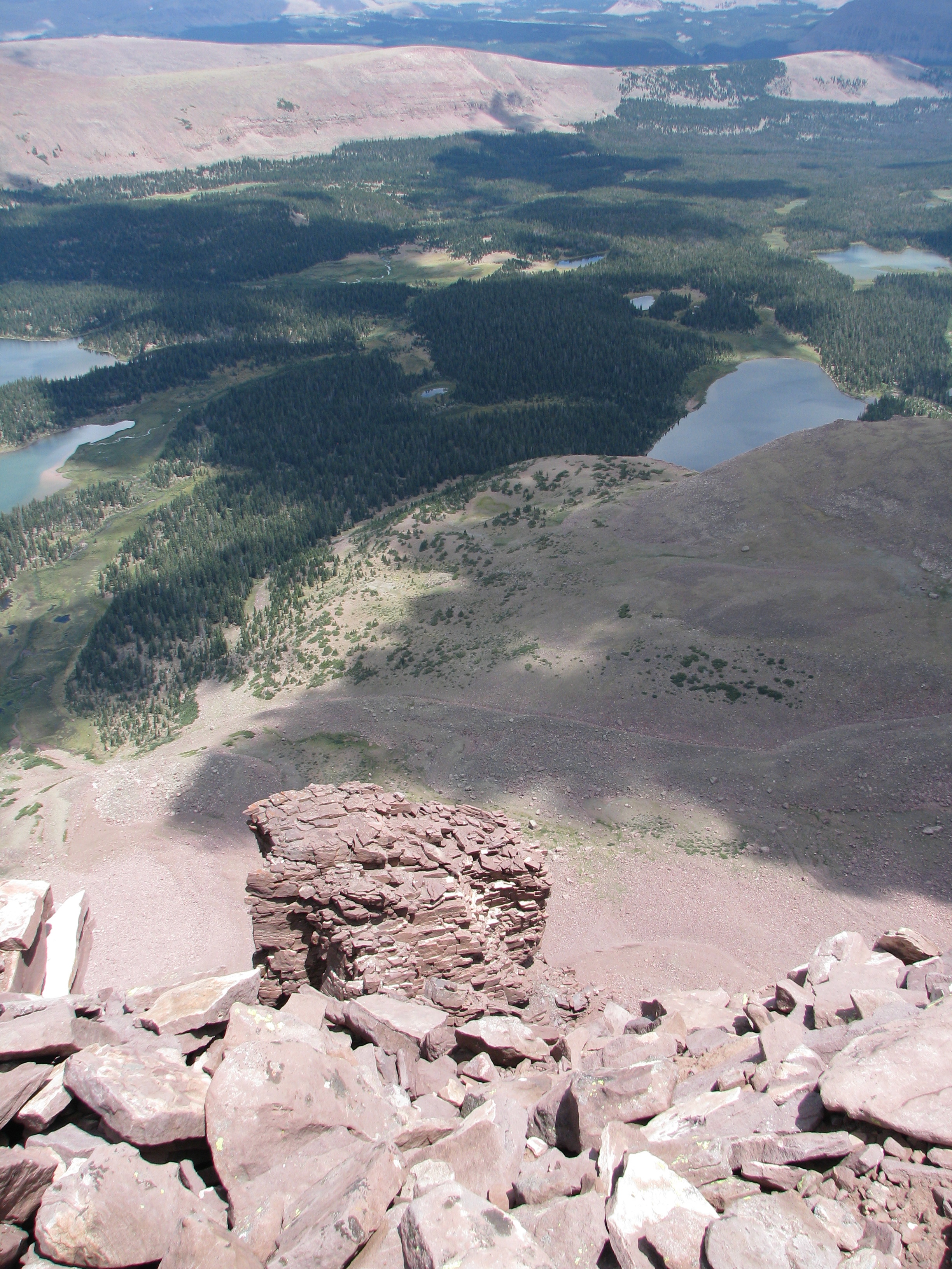
High Uintas overview.
They then followed the ridge and summited Mt Emmons. The bench mark photo below, though blurry, is proof.
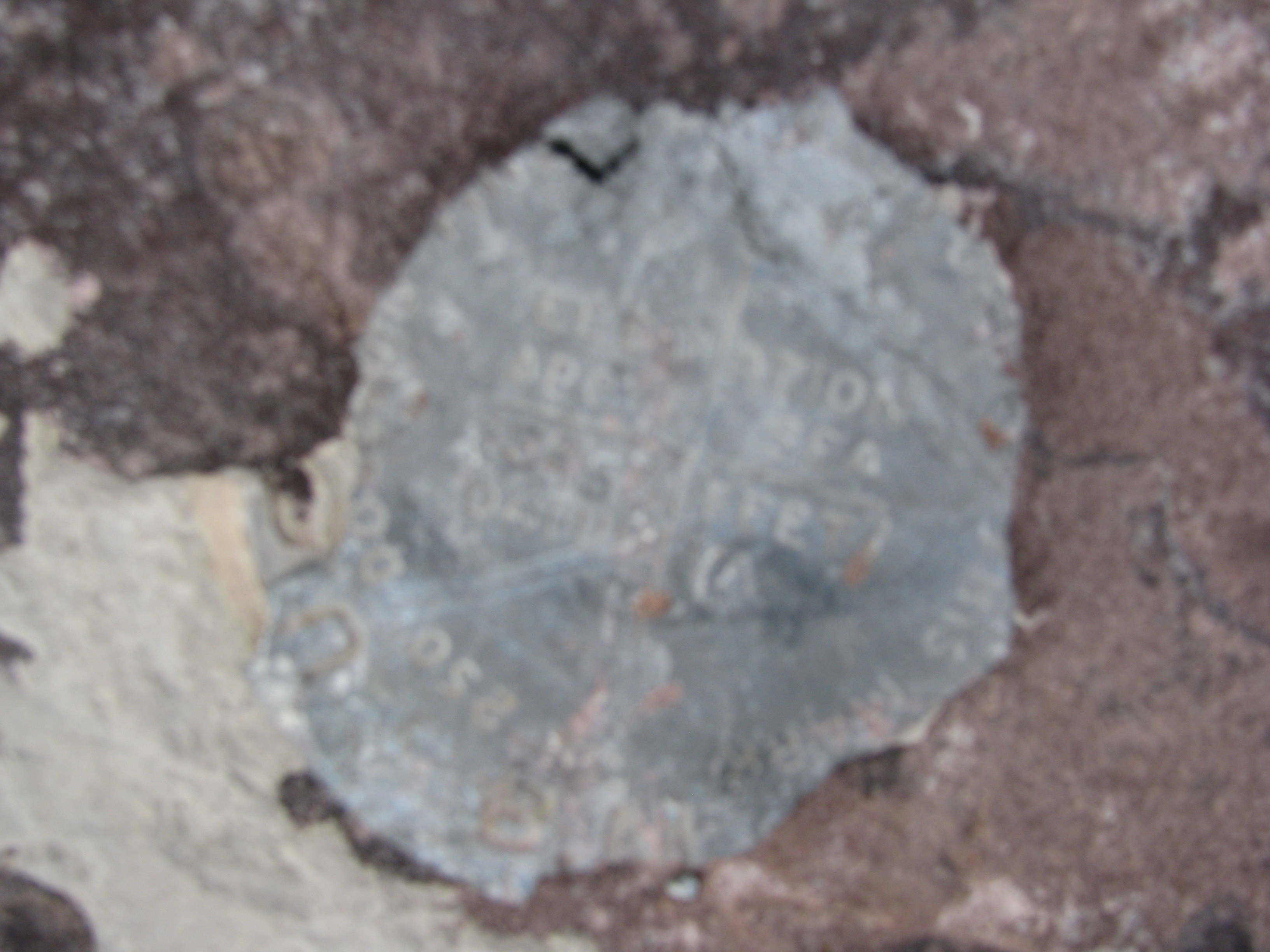
Mt. Emmons Bench Mark, Elevation 13,440 ft (4,097 m).
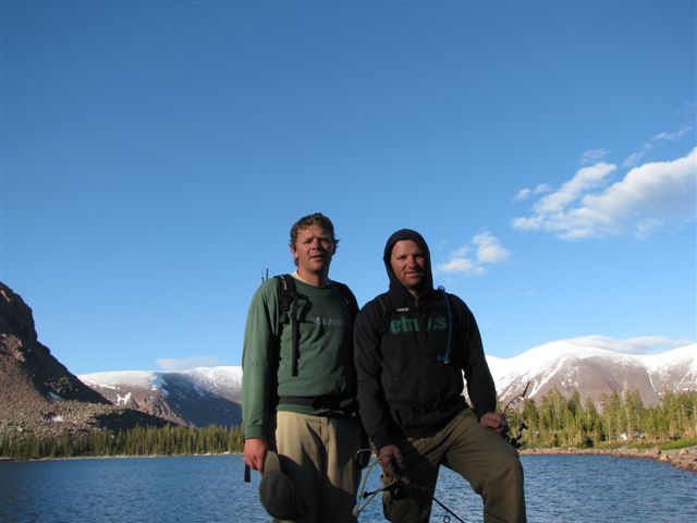
According to photo image time stamps, shortly after they had summited and were on their way down, Mr. Soccer and I had made it back to the saddle pass between the Lake Atwood basin and the Chain Lakes basin. This fact made the following picture rather interesting in that were it pixilated like a bajillion times, we might be able to see three more people in this “Sweating Selfie”.

A little time more and last camp is obtained.
When the two of us made it to the camp, it was then time to wait and see if the three brothers would make it before sunset. Slow fishing and relaxing ensued as dusk approached. However, with the setting of the sun the brothers were still not back and we all decided they had foregone the idea of making it back out to this camp. An hour after sun-set, and around the time we were all settling down in or tents, singing was heard from the ridge and headlamps were seen bouncing down the trail. Much relieved we welcomed them into the camp and listened to the stories of their day. Although it was late and we were out of energy, we conjured up another campfire music session. The duplication of the thumping stump from 2 nights prior was not possible, but a sack of harmonicas provided by MSRH allowed for accompaniment regardless of the key.
Day 4: Hikeout
The following morning the group quickly packed camp and organized for the hike out. I was well fed and feeling my oats so I set my own pace and lumbered on ahead of the group. I had taken on more ballast from the group but my pace was solid and though not trying to set a record pace for the 9 miles out, I wanted to get them over with as soon as possible. This of course was a downhill track, but with 3 miles remaining the trail levels out. Somewhere around this point I noticed my blood sugar to be dropping and I needed to refuel. My quickly attainable snacks were packed away deep, so I just blundered on. Upon arriving back at the truck at the heat of mid-day I found a plum and some thrice melted chocolate to bring my levels back up after which I decided to sleep until the others arrived. When the entire group showed up hungry and tired, we unceremoniously said goodbye to the Uintas for another year and ate fast food before we all went our separate ways. It is always fun to get back to civilization, but each year on that truck ride home something dies only to be renewed around Christmas when the planning for the next year’s adventure begins.