
Although other backpacking trips had been taken in previous years, this was the first “big year”. It was the first year that all the Brothers, and Brothers-in-Law were present. The group included the following men: Pop-Pop, MSRH, The Professor, Photoman, Mr. Soccer, Thumper, and I. These 7 have seemed to be the mainstays of the group. The relations and the reason for the name of this blog can be understood by the following graphic.
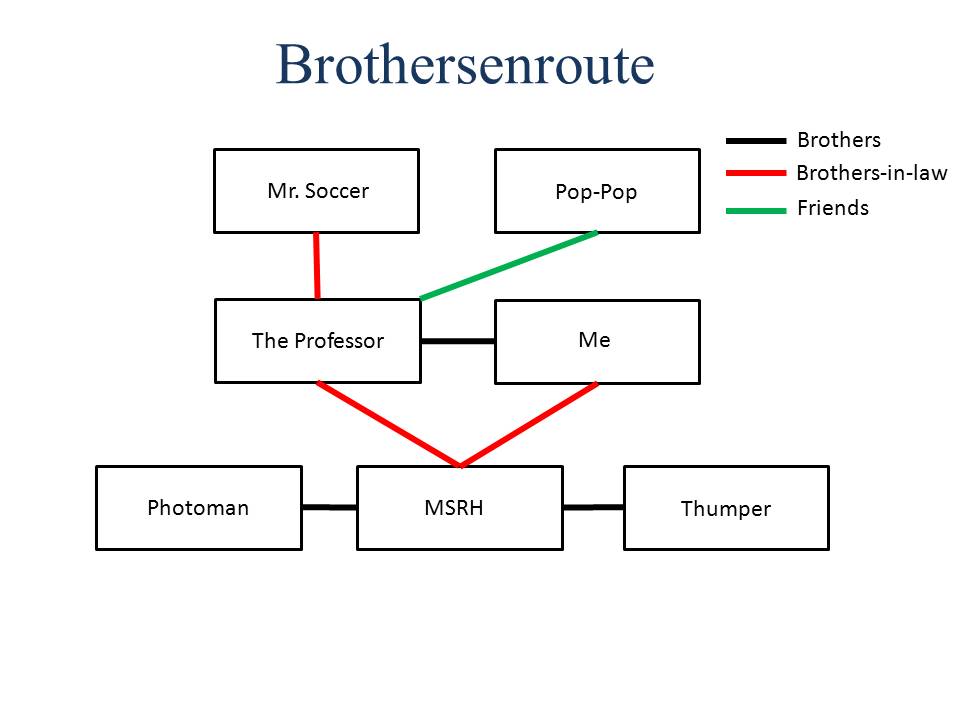
Nicknames have been adopted because that makes it fun, and I have yet to ask permission if I can post their faces all over my blog.
An important precursor to this first big trip was a trip the previous summer (2008) to the Chain Lakes Basin by The Professor, MSRH, Mr. Soccer, and Pop-Pop. Trial and error was a great educator. Another few trips of education were taken by me and some friends from work to Grandaddy Lake Basin in the summer of 2007 and Bulberry Lakes during the summer of 2008. This education included what to take, how much to take, what is truly needed, how many miles are possible with a heavily loaded pack. The Timothy Lakes Basin trip then became a fine tuning trip and truly enjoyable.
The Uinta Mountain range in Eastern Utah is a common summer destination for Brothersenroute because of the proximity. Timothy Lakes Basin is an area South of King’s Peak and West of Mt Emmons. Snow melts and lakes drain off eventually collecting and running down the Swift Creek drainage. The Swift Creek Trailhead can be accessed out of Mountain Home Utah which is just north of Duchesne Utah. Some people will use the Swift Creek Trail to tackle King’s Peak, South King’s Peak as well as the other peaks in the area. All topographical maps of this area can be accessed from the USGS website with the map locator & downloader feature. Mt. Emmons and Garfield Basin are the two main 7.5 inch topographical maps used for this trip.
We all arrived at the Swift Creek Trailhead around 1:00 p.m. on a Wednesday. It was raining in the typical Utah summer fashion. A light rain was followed by a gully washer for about five minutes, and then it lightened up to a sprinkle before fading out completely about 1 hour later. Our prior years’ education had prepared us for this occurrence, and since the trip was during the first of June, we actually expected precipitation. We donned our lightweight ponchos and let the deluge pass before starting up the trail.

Swift Creek Trailhead upon arrival.
After a short stroll on a flat and maintained path a bridge takes the trail across Swift Creek. Wild raspberries were noticed along the trail near the bridge, and could be a nice little treat before the climb, or just before getting back to the trailhead according to the time of year. After crossing the bridge, the trail starts to climb, and traverses the mountainside with a series of switchbacks. While the ponchos were great for keeping the misty rain out, they also soon created human saunas while climbing with loaded packs. After a while, the trail topped out on the ridgeline which made for much easier travel. Packs were adjusted and clothing changed and situated in order to more effectively regulate body temperatures. The trail at that point traveled for a mile or two along the ridgeline before dropping a short distance to the drainage valley. The trail then quizzically encounters 3 creek crossings within little over a mile. Having studied this trail beforehand, we were ready with “water-shoes” to accomplish this. We were not however prepared for the temperature of the water. Wow! After the creek crossings the trail then climbed again for another half mile before arriving at Deer Lake. This lake is a very picturesque and was in the plans for a longer stop for fishing, but the slow pace caused by the rain and the steepness of the trail only caused this to be a short stop. Small brook trout were seen surfacing, and a few 6-8 inchers were caught before we continued on. It was now getting late in the day, and exhaustion was setting in as the temperatures dropped. Snow drifts and soggy going was now the majority of the trail. Mr. Soccer and I powered on alone ahead of the group and struggled through the wet and snow. White Miller Lake was passed without a thought, and camp was finally set up in the dark South and East of Farmers Lake.

One of the numerous switchbacks before topping the ridge-line.

Crossing one of the creeks on the way back to the trailhead.
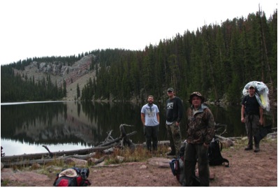
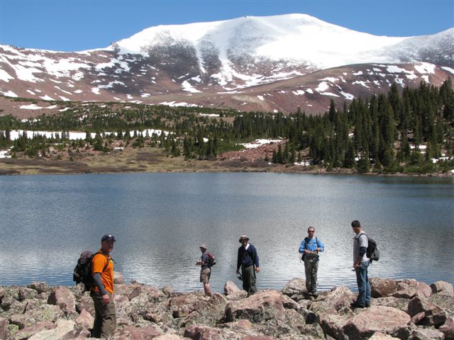
Thumper, Photoman, Pop-Pop, and The Professor on the Dam of Deer Lake.
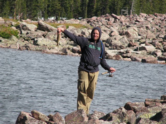
We awoke to 2 inches of snow on Thursday, but most everyone was prepared and few issues arose caused from the snow. The morning was overcast, misty and cold, but The Professor and I woke with the sun (if it could have been seen) to circumnavigate Farmers Lake while fishing. Few fish were caught, mostly with jigs, but it was good to be fishing again at 11,000 feet. The morning mist then burned off, and shortly thereafter, so did the snow. The rest of the group awoke and prepared breakfast slowly, still recovering from the previous day’s hike. All were ready before noon to get lines in as many lakes as possible, and a counterclockwise loop of Farmer’s Lake Basin was conducted. Five of the six lakes were fished without abundant success, but everyone caught a fish, and most caught several. Due to the early time of the year, it was noticed that the fish were small, and not very well nourished. By 6 that evening the group was back to camp ready for food and the night’s entertainment afforded by the guitars carried in, and a selected thumping stump. Guitars are crucial for Brothersenroute as an effective way to self-entertain between dinner and bed. If needed, the group will take turns carrying the guitars so as to afford this luxury. Mostly though, MSRH and Photoman carry the instruments.
MSRH with a typical sized cutthroat caught during day 2
The guitar carriers on the West shore of Farmers Lake.
Day 3 was an adventure into Timothy Lakes Basin. The plan was to hit all of the lakes in the basin in a clockwise path. The day’s hike started around 10 am, and after a short 45-minute hike, Center Timothy Lake accepted our lures, jigs, and flies. This lake contained both Cutthroat and Brook Trout that could be caught without much difficulty. Once again it wasn’t rapid fishing, but each hole contained a fish hungry enough to be caught. Upper Timothy Lake was then fished along the west shore. The northern side seemed to be the most productive with one hole producing a 12 to 14 inch fish every cast for a short time. The center of this lake was also still covered with ice. The most effective way to catch a fish was to cast the lure on the ice and then reel it back until it fell in the water nearest the ice. It seemed as if the fish were patrolling the ices edge for food. To the North of Upper Timothy we stopped for lunch, which included fresh fish, wheat crackers, and trail mix. It was then trekking above the treeline to the Carrol Lakes. These lakes produced similar results and by this time of the day we were all looking for bigger fish, so not much time was spent at any lake. The scenery with the recent snowfall, and boulder-ridden slopes was sufficient for us to be relishing our time regardless of the fish size. It was turning colder and getting darker, so we quickly hit East Timothy before heading back to camp. We had successfully fished every lake within the upper part of Timothy Lake Basin. Camp offered freezer dried meals and acoustic renditions of The White Stripes, Neil Young, and The Boss. It had been a long day with a lot of ground covered, with a difficult return to the trailhead the following day so bed was unusually early that night.
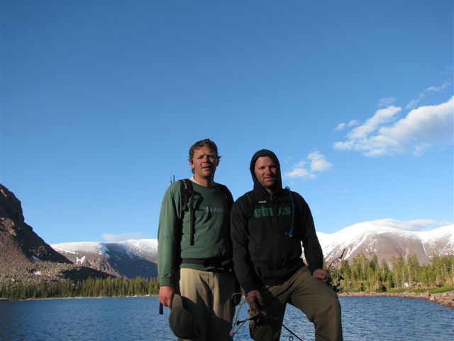
Center Timothy Lake with Pop-Pop, Me, Thumper, The Professor and Mr. Soccer.
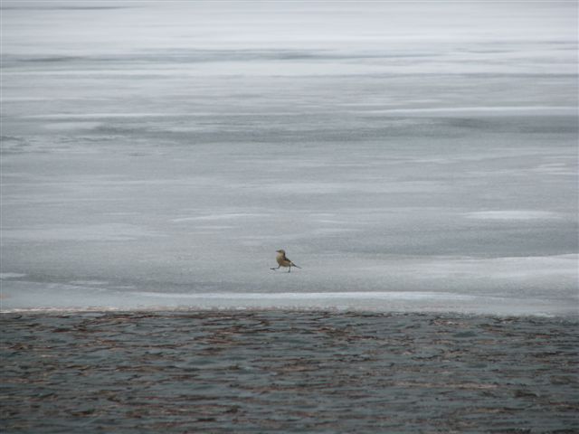
A bird found the ice on Upper Timothy as useful as we did.

Upper Caroll Lake with East Caroll Lake in the background. The snowy ridgeline to Mt. Emmons is also seen.
The 4th day was our hike back out to the trailhead. As we all had long drives back to our respective homes, we started early and travelled relatively quickly. We made it down to the creek crossings faster than we anticipated, but that didn’t make the water any warmer. And is always the case, the trucks and civilization seemed momentarily foreign after the short 4 days absence. It was also a paradigm shift to realize while returning home that the distance traveled on foot for the last 4 days was covered in 40 minutes by vehicle.
